Ustyurt Plateau
Ustyurt Plateau
A vast stone desert in western Uzbekistan, the Ustyurt Plateau impresses with its sheer cliffs (chinki), absolute silence, and star-filled nights. A raw territory, accessible only by 4×4 with a guide.
The Ustyurt Plateau is a vast desert of stone and clay stretching between the Aral Sea, the Caspian Sea, and the Amu Darya delta. Located primarily in Karakalpakstan, at the far west of Uzbekistan, it covers several hundred thousand square kilometers. Its sheer cliffs—the chinki—drop dozens of meters, carving out a lunar landscape that few travelers reach. It is a territory of silence, wind, and raw geology.
Practical information at a glance
- Access: Only by 4×4 with an experienced driver; no paved roads on the plateau.
- Usual starting point: Muynak, the former port city of the Aral Sea, or Nukus, capital of Karakalpakstan.
- Recommended duration: Minimum 2 to 4 days to explore the chinki and interior sites.
- Best time: April–May and September–October; summers regularly exceed 40 °C, winters are freezing.
- Essential equipment: Large quantities of water, spare fuel, tent or organized bivouac through your agency.
- Accessibility for people with reduced mobility: Not accessible.
What to see
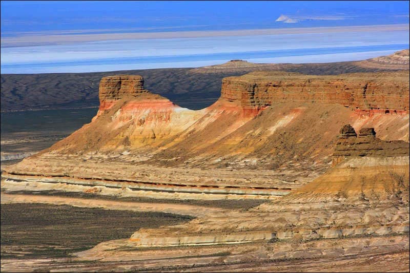
The plateau presents itself as an almost level rocky table, interrupted by the chinki: vertical scarps in ochre, beige, and white tones. The surface alternates between reg (stony ground) and areas of cracked clay. In places, isolated geological formations rise like sentinels. Wildlife includes gazelles, sand foxes, and raptors. At night, the complete absence of light pollution offers a starry sky of rare density.
History and context
The plateau was once crossed by caravans linking Persia to the Kazakh steppe. Ruined medieval caravanserais persist along certain routes, testimony to commerce long disappeared. The Karakalpak and Kazakh nomadic peoples long grazed their herds on these lands. The ecological catastrophe of the Aral Sea, whose ancient shores the plateau borders, profoundly transformed the local climate from the 1960s onward.
Highlights of the visit
The chinki
These cliffs border the plateau for hundreds of kilometers. Certain viewpoints allow you to overlook a desert plain from a height of 150 meters. Sunset casts long shadows across the colored rock faces.
Ruined caravanserais
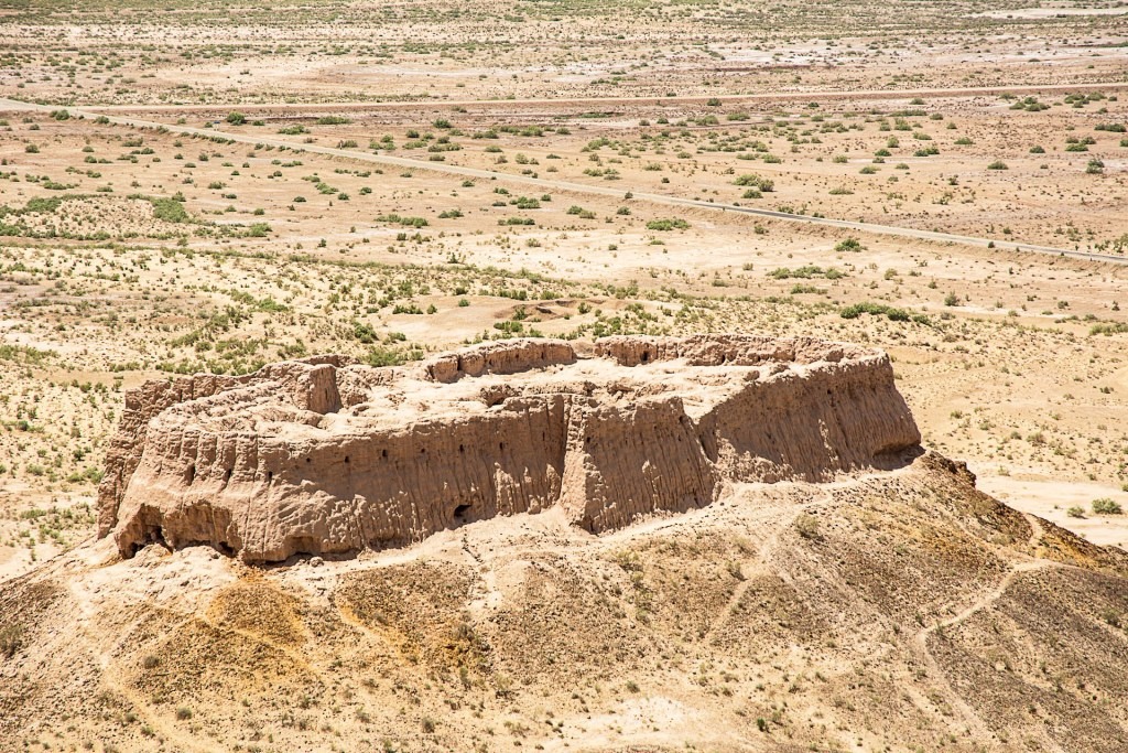
A few medieval mud-brick structures remain, partially buried by sand. They remind us that this desert was once a strategic passage route between Central Asia's great civilizations.
Bivouacking under the stars
Sleeping on the plateau, far from any settlement, is the core experience of the journey. The silence is absolute, the night sky unrivaled in inhabited zones of Uzbekistan.
Photography tips
The golden light of dawn and dusk reveals the texture of the cliffs and the subtle colors of the ground. Avoid midday: white light flattens relief. A wide-angle lens is ideal for the chinki; a telephoto lens captures wildlife from a distance. No known photography restrictions on the plateau itself.
Location and access
The Ustyurt Plateau is located in Karakalpakstan, an autonomous region in western Uzbekistan. The city of Nukus is the main logistics hub: it has an airport with connections to Tashkent. From Nukus, allow several hours of track travel by 4×4 to reach the first escarpments. Muynak and the wrecks of the Aral Sea typically form the first stop before heading up onto the plateau. This circuit is almost exclusively organized by specialist agencies; no public transport exists.
Nearby sites
- Muynak — ship graveyard of the Aral Sea: the rusted hulks resting on the former seabed are the most striking symbol of ecological disaster.
- Savitsky Museum in Nukus: one of the world's most important collections of Russian avant-garde art, housed in the capital of Karakalpakstan.
- Fortresses of Khorezm — Ayaz Kala: ancient mud-brick citadels visible from the desert, on the border between the plateau and the Amu Darya delta.
Frequently asked questions
Spring (April–May) and autumn (September–October) offer manageable temperatures. Summer regularly exceeds 40 °C and winter can be very cold with violent winds.
Not recommended. The lack of roads, signage, and water sources makes independent navigation dangerous. An experienced local driver and reliable 4×4 vehicle are essential.
Plan a minimum of 2 days to reach the chinki and bivouac. A 4-day circuit allows exploration of several plateau zones and combination with Muynak.
Certain zones near the Kazakh border may require authorization. Your local agency typically handles these administrative formalities.
Yes. The classic circuit combines Nukus, the Savitsky Museum, Muynak, and the plateau. You can then continue to Khiva, a few hours away, to discover the fortresses of Khorezm.
Give it a go!
Our local experts arrange this activity for you.